Nyandeni Local Municipality (Nyandeni)
Nyandeni Local Municipality is a local municipality in the OR Tambo District, situated in the Eastern Cape of South Africa. Its administrative seat is the town of Libode. The entire municipal area falls within the former Transkei homeland area.
The urban population is mainly located in the two small towns of Libode and Ngqeleni.
Scattered, low-density rural settlements dominate the municipality. 79% of households reside in traditional or village type settlements. These settlements are loosely scattered throughout the entire municipal area and are surrounded by communal grazing and arable lands. The majority of residential structures are self-built. Apart from a few trading stores, there is little sign of any significant economic activity within the rural settlements.
Many of the families in the rural regions of the municipality were formerly supported by men who worked as migrant labour in local mines. Subsequent retrenchment at the mines has left these communities with scant means to survive.
About 77% of households can be regarded as indigents with access to either no income or incomes of less than R800 (US $108) per month.
Most of the education institutions in Nyandeni cater to lower level schooling. Of the 426 schools in the Nyandeni area, 64% are overcrowded or highly overcrowded, according to the OR Tambo District office.
The spread of HIV/AIDS is an extremely severe and urgent problem in the area. In 2009 the HIV/AIDS prevalence rate was as high as 50%-60% among tested cases; these cases were mainly females who participated in voluntary testing during their regular pregnancy visits to local clinics.
The 2001 census divided the municipality into the following main places:
Map - Nyandeni Local Municipality (Nyandeni)
Map
Country - South_Africa
 |
 |
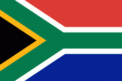
| Flag of South Africa | |
About 80% of the population are Black South Africans. The remaining population consists of Africa's largest communities of European (White South Africans), Asian (Indian South Africans and Chinese South Africans), and multiracial (Coloured South Africans) ancestry. South Africa is a multiethnic society encompassing a wide variety of cultures, languages, and religions. Its pluralistic makeup is reflected in the constitution's recognition of 11 official languages, the fourth-highest number in the world. According to the 2011 census, the two most spoken first languages are Zulu (22.7%) and Xhosa (16.0%). The two next ones are of European origin: Afrikaans (13.5%) developed from Dutch and serves as the first language of most Coloured and White South Africans; English (9.6%) reflects the legacy of British colonialism and is commonly used in public and commercial life.
Currency / Language
| ISO | Currency | Symbol | Significant figures |
|---|---|---|---|
| ZAR | South African rand | Rs | 2 |
| ISO | Language |
|---|---|
| AF | Afrikaans language |
| EN | English language |
| ST | Sotho language |
| SS | Swati language |
| TS | Tsonga language |
| TN | Tswana language |
| VE | Venda language |
| XH | Xhosa language |
| ZU | Zulu language |


